
Activity
Geography Challenge

As learners study world cultures, they'll benefit greatly from a general sense of where countries around the world are located. One of the best ways students can develop this key geographical background knowledge is by spending a good amount of time looking carefully at a map, which can get rather boring. Liven up your learner's study of geography by getting them started on these three challenges.
Related learning resources
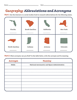
Geography: Abbreviations and Acronyms
Worksheet
Geography: Abbreviations and Acronyms
Research meets geography and grammar in this abbreviation challenge!
5th Grade
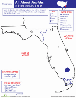
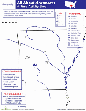
Worksheet

Kentucky Geography
Worksheet
Kentucky Geography
How much does your student know about Kentucky's geography? Give him a fun mapping challenge with this State Activity Sheet.
5th Grade
Social studies
Worksheet

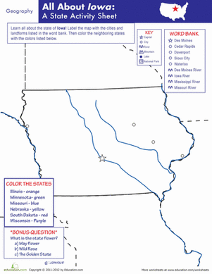
South Dakota Geography
Worksheet
South Dakota Geography
Geography buffs, here's a challenge for you! This South Dakota State Activity Sheet is perfect for students learning about states and state capitals.
5th Grade
Social studies
Worksheet